Did you know that Canada experiences an average of 30,000 weather alerts each year? From severe storms and blizzards to extreme cold and heavy rainfall, Canadian weather can be unpredictable and pose significant risks to drivers on the road. Being aware of and prepared for these weather alerts is crucial for safe and responsible driving.
In this article, I will explore the different types of Canadian weather alerts issued by Environment Canada and provide essential tips on how drivers can respond to them effectively. Whether you’re a seasoned driver or a beginner, understanding how to navigate through challenging weather conditions can make all the difference in ensuring your safety on the road.
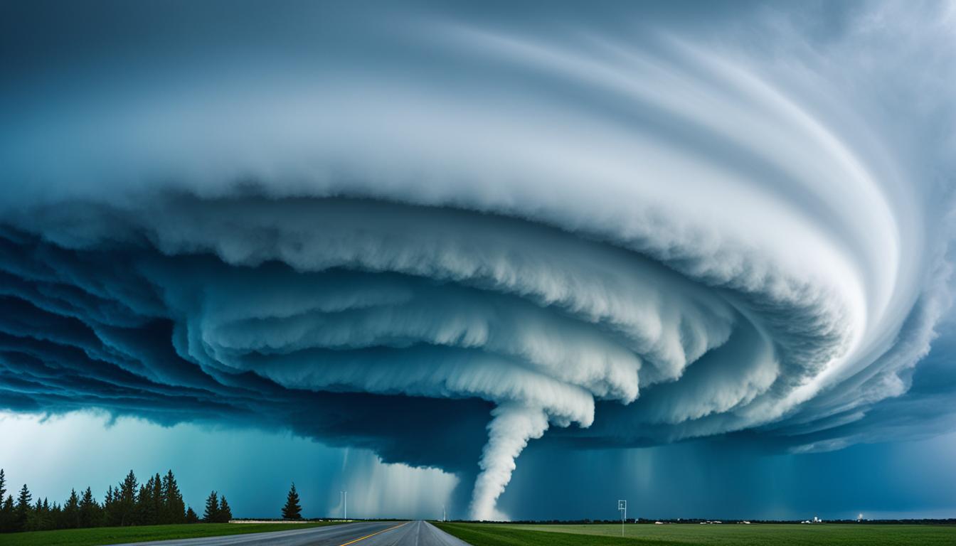
Types of Weather Alerts
Environment Canada issues a variety of weather alerts to warn Canadians about hazardous conditions. These alerts play a crucial role in providing timely and important information to help people stay safe and prepared in the face of severe weather.
One way to stay informed is through weather advisory apps that provide real-time weather updates and emergency notifications. These apps allow users to receive alerts directly on their smartphones, ensuring they have access to the latest information no matter where they are.
Here are some of the different types of weather alerts issued by Environment Canada:
- Arctic Outflow: This alert is specific to coastal regions in British Columbia and is issued when a combination of wind speed and temperature results in a wind chill of -20 or lower for 6 hours or more. No separate wind warning is required.
- Blizzard: A blizzard warning is issued nationally, except north of the tree line, when winds of 40 km/hr or greater are expected to cause widespread reductions in visibility to 400 meters or less due to blowing snow or blowing snow in combination with falling snow. This alert lasts for at least 4 hours.
- Blowing Snow: This advisory is issued nationally, south of the tree line, when blowing snow caused by winds of at least 30 km/h is expected to reduce visibility to 800 meters or less for at least 3 hours.
These are just a few examples of the weather alerts issued by Environment Canada. Each alert is based on specific threshold criteria that indicate the severity and duration of the weather hazard. It is important to pay attention to these alerts and take appropriate measures to ensure personal safety and well-being.
Remember: Stay prepared, stay informed, and stay safe.
Arctic Outflow
An Arctic outflow warning is issued by Environment Canada for coastal British Columbia regions when there is a combination of wind speed and temperature that results in a wind chill of -20 or lower for 6 hours or more. This alert does not require a separate wind warning.
Arctic Outflow Warning Criteria
| Criteria | Threshold |
|---|---|
| Wind Speed | Varies based on region |
| Temperature | Must result in a wind chill of -20 or lower |
| Duration | Must persist for 6 hours or more |
Blizzard
A Blizzard warning is issued by Environment Canada nationally, except north of the tree line, when winds of 40 km/hr or greater are expected to cause widespread reductions in visibility to 400 meters or less due to blowing snow or blowing snow in combination with falling snow. This alert lasts for at least 4 hours, with conditions north of the tree line expected to last for at least 6 hours.
Key Features of a Blizzard Warning:
- Issued nationally, except north of the tree line
- Strong winds of 40 km/hr or greater
- Widespread reductions in visibility to 400 meters or less
- Caused by blowing snow or blowing snow in combination with falling snow
- Alert lasts for at least 4 hours
- Conditions north of the tree line expected to last for at least 6 hours
Blizzards can be extremely dangerous, especially for drivers. The reduced visibility and icy road conditions make it challenging to navigate safely. It is crucial to stay informed about Blizzard warnings and take appropriate precautions to ensure your safety.
| Blizzard Warning Criteria | Duration |
|---|---|
| Winds of 40 km/hr or greater | Lasts for at least 4 hours |
| Visibility reduced to 400 meters or less | Conditions north of the tree line last for at least 6 hours |
When driving in a Blizzard, it is essential to take the necessary precautions to stay safe:
- Stay informed: Monitor weather updates and Blizzard warnings issued by Environment Canada.
- Plan ahead: If possible, avoid driving in snowy or blizzard conditions.
- Check road conditions: Before heading out, check road reports and closures.
- Reduce speed: Drive at a safe, reduced speed, and maintain a safe distance from other vehicles.
- Use headlights: Ensure your headlights are on and use low beams to improve visibility.
- Be prepared: Pack an emergency kit with essential items like warm clothing, blankets, food, and water.
By following these guidelines and staying alert to Blizzard warnings, you can protect yourself and others while driving in hazardous winter conditions.
Blowing Snow
A Blowing Snow Advisory is a national alert issued by Environment Canada south of the tree line. It is activated when winds of at least 30 km/h cause blowing snow, leading to reduced visibility of 800 meters or less for a minimum of 3 hours.
Blowing snow can significantly impact road conditions, making driving hazardous and increasing the risk of accidents. It is crucial for drivers to be aware of the Blowing Snow Advisory and take appropriate precautions when encountering such conditions.
During a Blowing Snow Advisory, it is important to:
- Reduce your speed and increase following distance to maintain control of the vehicle
- Use low beam headlights or fog lights to improve visibility
- Avoid unnecessary travel if possible
- Stay informed of the latest weather updates and road conditions
“Blowing snow poses a serious threat to drivers, worsening visibility and making roads treacherous. By staying alert and adjusting our driving habits, we can navigate safely through these challenging conditions.”
~Environment Canada
Blowing Snow Advisory Safety Tips
Here are some additional safety tips to consider during a Blowing Snow Advisory:
- Avoid passing snow plows or other large vehicles that may create a significant spray of blowing snow
- Keep extra distance from vehicles ahead to allow for sudden braking or lane changes
- Ensure that all windows, mirrors, and lights are clear of snow and ice before starting your journey
- If you must travel, inform someone of your route and expected arrival time
- Carry an emergency kit with essentials such as blankets, water, food, a flashlight, and a fully charged mobile phone
Blowing Snow Advisory Comparison Chart
| Severity Level | Visibility Reduction | Duration | Affected Areas |
|---|---|---|---|
| Blowing Snow Advisory | 800 meters or less | At least 3 hours | Nationally, south of the tree line |
| Blizzard Warning | 400 meters or less | At least 4 hours | Nationally, except north of the tree line |
| Snow Squall Warning | Sudden and intense snowfall | Up to 3 hours | Localized areas |
Dust Storm
A Dust Storm Warning is a crucial alert issued by Environment Canada for the provinces of Alberta, Saskatchewan, and Manitoba. This warning is activated when blowing dust is expected to occur, significantly reducing visibility to 800 meters or less for one hour or more. Dust storms can create hazardous driving conditions, posing risks to motorists on the road.
Dust storms are characterized by strong winds that pick up loose particles of dirt and dust, creating a dense cloud that blankets the affected area. Blowing dust can severely impair visibility, making it difficult for drivers to see the road ahead and other vehicles around them. In such situations, it is crucial for drivers to exercise extreme caution and take appropriate measures to ensure their safety.
During a Dust Storm Warning, it is recommended that drivers:
- Stay informed: Monitor local weather updates and stay updated with the latest Dust Storm Warning information issued by Environment Canada.
- Limit travel: If possible, avoid unnecessary travel during a dust storm. If already on the road, consider finding a safe place to pull over until the storm subsides.
- Reduce speed: Slow down and adjust your driving speed according to the visibility conditions. Decreasing your speed can help you maintain control of your vehicle and react to any sudden obstacles that may appear.
- Use low beam lights: Turn on your low beam lights to increase your visibility to other drivers and enhance your own visibility in reduced visibility conditions.
- Maintain distance: Keep a safe distance from the vehicle ahead to allow for ample reaction time in case of sudden stops or obstacles.
- Use hazard lights: If the visibility is extremely poor, consider using your hazard lights to alert other drivers of your presence.
Remember, driving in a dust storm can be extremely hazardous. It is crucial to prioritize your safety and the safety of others on the road by following the recommended precautions during a Dust Storm Warning.
Extreme Cold
In Canada, extreme cold weather can pose significant risks to individuals, especially when the temperature or wind chill reaches dangerous levels. To ensure the safety and well-being of people, Environment Canada issues Extreme Cold Warnings for various regions across the country. These warnings are based on specific temperature or wind chill criteria and are crucial in alerting residents and travelers to take necessary precautions.
The Extreme Cold Warnings are issued for the following regions:
- South-central and Southwestern Ontario
- Southeastern Ontario
- Southern Interior and Coastal B.C.
- Atlantic Canada except Labrador
- Western, Central, and Eastern Quebec
- Central Interior B.C.
- Northern Ontario
- Prairies – Alberta, Southern Saskatchewan, and Southern Manitoba
- Far Northern Ontario, northern Saskatchewan, and northern Manitoba
- Northern B.C.
- Labrador
- Northern Quebec
- Yukon
- NWT
- Baffin Island
- Nunavik
Extreme Cold Warnings are issued when the temperature or wind chill is expected to reach specific thresholds for at least two hours. These thresholds can range from -30°C to -55°C, depending on the region. It is important for individuals in these areas to pay close attention to these warnings and take appropriate measures to stay safe.
During extreme cold weather, it is advised to:
- Stay indoors as much as possible
- Wear warm and layered clothing
- Cover exposed skin to prevent frostbite
- Minimize outdoor activities and limit exposure to cold temperatures
- Keep homes heated adequately and ensure proper insulation
- Check on vulnerable individuals, such as the elderly or those with health conditions
To better understand the severity of extreme cold weather, let’s take a look at an example of an Extreme Cold Warning issued in Ontario:
Extreme Cold Warning in South-central and Southwestern Ontario.
Temperature or wind chill: -35°C or colder.
Duration: At least two hours.
During an Extreme Cold Warning, it is crucial to prioritize safety and take necessary precautions to avoid any cold-related injuries or health issues. Stay informed and follow the guidance provided by local authorities and weather agencies.
Now, let’s take a closer look at another type of weather alert: Flash Freeze.
Flash Freeze
A Flash Freeze Warning is issued by Environment Canada nationally when there is a rapid drop in temperatures, causing significant ice formation. This occurs due to the freezing of residual water from melted snow or falling rain. Flash freezes can create extremely hazardous driving conditions as roads become icy and slippery, increasing the risk of accidents.
When a Flash Freeze Warning is issued, it is crucial to take immediate precautions to ensure your safety on the road. Here are some important steps to follow:
- Stay informed: Stay updated with weather alerts and forecasts to be aware of any Flash Freeze warnings in your area. Utilize reliable weather alerts apps or check local news bulletins for the latest information.
- Plan your travel: If possible, avoid unnecessary travel during Flash Freeze conditions. If you must go out, plan your route carefully and choose well-maintained roads that are less prone to icing.
- Adjust your driving: Reduce your speed and increase your following distance to account for the reduced traction on icy roads. Avoid sudden maneuvers and allow extra time for braking.
- Winter driving techniques: Practice safe winter driving techniques, such as using winter tires, keeping your windshield clear of ice and snow, and using your vehicle’s defrost and windshield wiper systems effectively.
Remember, a Flash Freeze Warning indicates a rapid and significant change in weather conditions. Taking these precautions will help you navigate the challenging road conditions and minimize the risk of accidents and injuries.

Fog
A Fog Advisory is issued by Environment Canada when low visibilities in fog are expected for extended periods of time. In Newfoundland, New Brunswick, Nova Scotia, and Prince Edward Island, the advisory is issued when low visibilities in fog are expected for at least 18 hours. In other regions across Canada, including [specific regions not mentioned in the detailed notes], low visibilities in fog are expected for at least six hours.
| Region | Minimum Duration of Low Visibility |
|---|---|
| Newfoundland | At least 18 hours |
| New Brunswick | At least 18 hours |
| Nova Scotia | At least 18 hours |
| Prince Edward Island | At least 18 hours |
| Other Regions across Canada | At least 6 hours |
Freezing Drizzle
A Freezing Drizzle Advisory is issued by Environment Canada nationally when a period of freezing drizzle is expected for at least eight hours.
Freezing Rain
In Canada, freezing rain can create hazardous conditions for transportation and property. To alert residents, Environment Canada issues Freezing Rain Warnings for various regions across the country. These warnings serve as a crucial heads-up for the potential dangers that freezing rain can pose.
Freezing Rain Warnings are issued when freezing rain is expected to persist for a certain duration, which can range from two to four hours, depending on the region. The warnings are specifically designed to inform and caution individuals about the imminent risks associated with freezing rain.
Regions in Canada that may receive Freezing Rain Warnings include:
- British Columbia
- Yukon
- Alberta
- Saskatchewan
- Manitoba
- Northwest Territories
- Nunavut
- Ontario
- Quebec
- Nova Scotia
- New Brunswick
- Prince Edward Island
- Magdalen Islands
- Newfoundland
- Labrador
To ensure the safety of both pedestrians and drivers, it is essential to stay informed and take the necessary precautions when a Freezing Rain Warning has been issued. Proper planning and adjusting travel schedules can significantly mitigate the risks associated with freezing rain.
Environment Canada’s Freezing Rain Warnings provide valuable information that allows individuals to make informed decisions, protecting themselves and their property from the potential dangers that freezing rain can bring.

| Region | Freezing Rain Warning Duration |
|---|---|
| British Columbia | 2 hours |
| Yukon | 4 hours |
| Alberta | 2 hours |
| Saskatchewan | 4 hours |
| Manitoba | 2 hours |
| Northwest Territories | 4 hours |
| Nunavut | 4 hours |
| Ontario | 2 hours |
| Quebec | 2 hours |
| Nova Scotia | 2 hours |
| New Brunswick | 2 hours |
| Prince Edward Island | 2 hours |
| Magdalen Islands | 2 hours |
| Newfoundland | 2 hours |
| Labrador | 4 hours |
Conclusion
Weather forecast alerts and storm alerts in Canada are essential tools for promoting road safety. By staying informed about the different types of alerts issued by Environment Canada and learning how to respond to them, drivers can take proactive measures to ensure their safety on the road. It is crucial to adapt driving behavior accordingly and make informed decisions based on the prevailing weather conditions.
To stay updated with real-time weather information, it is recommended to utilize weather alerts apps, which provide instant notifications about weather forecast alerts and storm alerts. These apps can help drivers plan their journeys, avoid dangerous weather conditions, and take alternative routes when necessary. Additionally, following local weather forecasts can provide valuable insights into the ever-changing weather patterns in specific regions of Canada.
Being prepared for severe weather conditions is an integral part of maintaining safe driving practices. Drivers should familiarize themselves with the different types of weather alerts and their implications. This knowledge can assist in making informed decisions about when to postpone or reschedule travel plans in the event of a severe weather warning. By prioritizing personal safety and taking precautionary measures, drivers can navigate Canadian roads with confidence, even during challenging weather conditions.
FAQ
What are Canadian weather alerts?
How can I receive real-time weather updates?
What is an Arctic outflow warning?
What is a blizzard warning?
What is a blowing snow advisory?
What is a dust storm warning?
What are extreme cold warnings?
What is a flash freeze warning?
When is a fog advisory issued?
When is a freezing drizzle advisory issued?
When is a freezing rain warning issued?
Source Links
- https://support.sasktel.com/app/answers/detail/a_id/24431/~/understanding-alert-ready-emergency-alerts-on-your-wireless-phone
- https://www.canada.ca/en/environment-climate-change/services/types-weather-forecasts-use/public/criteria-alerts.html
- https://www.canada.ca/en/environment-climate-change/services/weather-general-tools-resources/how-to-use-public-alert.html